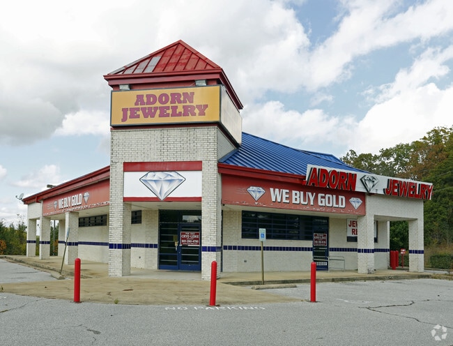
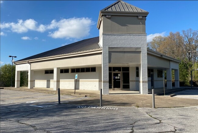
Property Record
4910 Austin Peay Hwy, Memphis, TN 38128
NEARBY LISTINGS FOR SALE OR LEASE
Property Detail
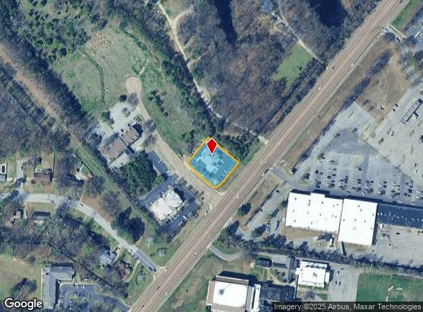
4910 Austin Peay Hwy
D0-147-0-0438
Raleigh Commons Phase 2
Storebuilding
WS AUSTIN PEAY HWY COR RALEIGH COMMONS DR (PD) (NW) MAP:85M
X
Shelby
47157C0285F
Tennessee
2024
0.68 AC
2025
North
020541
Memphis
2,988 SF
Memphis, TN-MS-AR
DEMOGRAPHICS near 4910 Austin Peay Hwy
1 Mile
3 Mile
5 Mile
2024 Total Population
6,150
58,712
134,835
2029 Population
5,958
57,401
131,996
Pop Growth 2024-2029
(3.12%)
(2.23%)
(2.11%)
Average Age
40
36
37
2024 Total Households
2,311
21,505
49,321
HH Growth 2024-2029
(3.25%)
(2.34%)
(2.21%)
Median Household Inc
$47,641
$55,322
$52,522
Avg Household Size
2.50
2.70
2.70
2024 Avg HH Vehicles
2.00
2.00
2.00
Median Home Value
$153,142
$161,455
$164,275
Median Year Built
1979
1978
1977
Nearby Places
Map Layers
Map Styles
 Street
 Aerial
- Restaurants
- Banks
- Shops
- Fitness
- Groceries
PUBLIC TRANSPORTATION
AIRPORT
Memphis International
DRIVE
WALK
Distance
Memphis International
30 min
16.0 mi
SALE & LEASE HISTORY
LISTING DATE
SALE/LEASE

Sep 30, 2021
For Lease
Nearby Properties
Address
Land Use
TOTAL SIZE
Lot Size
Zoning
Address
Land Use
TOTAL SIZE
Lot Size
Zoning
78,603 SF
23.30 AC
R-6
Address
Land Use
TOTAL SIZE
Lot Size
Zoning
38,200 SF
22.60 AC
RU-3
Address
Land Use
TOTAL SIZE
Lot Size
Zoning
198,103 SF
17.75 AC
CG-MS
Address
Land Use
TOTAL SIZE
Lot Size
Zoning
11,446 SF
29.76 AC
RU-3
Address
Land Use
TOTAL SIZE
Lot Size
Zoning
56,983 SF
12.34 AC
RU-3
Address
Land Use
TOTAL SIZE
Lot Size
Zoning
39,018 SF
22.21 AC
RU-2
Address
Land Use
TOTAL SIZE
Lot Size
Zoning
22,798 SF
9.63 AC
RU-3
Address
Land Use
TOTAL SIZE
Lot Size
Zoning
67,640 SF
20.28 AC
R-M
Address
Land Use
TOTAL SIZE
Lot Size
Zoning
45,939 SF
5.70 AC
R-10
Address
Land Use
TOTAL SIZE
Lot Size
Zoning
181,319 SF
14.82 AC
CMU-2
Address
Land Use
TOTAL SIZE
Lot Size
Zoning
50,447 SF
6.28 AC
R-10
Address
Land Use
TOTAL SIZE
Lot Size
Zoning
85,332 SF
10.51 AC
R-M
Address
Land Use
TOTAL SIZE
Lot Size
Zoning
180,630 SF
21.89 AC
CMU-2
Address
Land Use
TOTAL SIZE
Lot Size
Zoning
50,538 SF
5 AC
R-10
Address
Land Use
TOTAL SIZE
Lot Size
Zoning
58,484 SF
19.95 AC
RU-3
Address
Land Use
TOTAL SIZE
Lot Size
Zoning
69,158 SF
7.75 AC
RU-3
Address
Land Use
TOTAL SIZE
Lot Size
Zoning
93,514 SF
12.47 AC
R-8
Address
Land Use
TOTAL SIZE
Lot Size
Zoning
26,544 SF
17.63 AC
RU-3
Address
Land Use
TOTAL SIZE
Lot Size
Zoning
101,800 SF
15.97 AC
CMU-2
Address
Land Use
TOTAL SIZE
Lot Size
Zoning
66.90 AC
CMU-2
Address
Land Use
TOTAL SIZE
Lot Size
Zoning
28,512 SF
7 AC
CMU-3
Address
Land Use
TOTAL SIZE
Lot Size
Zoning
74,934 SF
15.37 AC
RU-3
Address
Land Use
TOTAL SIZE
Lot Size
Zoning
76,451 SF
9.36 AC
CG-MS
Address
Land Use
TOTAL SIZE
Lot Size
Zoning
54,993 SF
20.39 AC
R-10
Address
Land Use
TOTAL SIZE
Lot Size
Zoning
20,552 SF
2.30 AC
CMU-2
Address
Land Use
TOTAL SIZE
Lot Size
Zoning
105,391 SF
4.82 AC
CMU-3
Address
Land Use
TOTAL SIZE
Lot Size
Zoning
33,971 SF
3.43 AC
CG-MS
Address
Land Use
TOTAL SIZE
Lot Size
Zoning
157.98 AC
AP
Address
Land Use
TOTAL SIZE
Lot Size
Zoning
36,519 SF
4.02 AC
RU-3
Address
Land Use
TOTAL SIZE
Lot Size
Zoning
47,465 SF
12.55 AC
R-M
The World's #1 Commercial Real Estate Marketplace
Connect with us
© 2025 CoStar Group
The information above has been obtained from sources believed reliable. While we do not doubt its accuracy we have not verified it and make no guarantee, warranty or representation about it. It is your responsibility to independently confirm its accuracy and completeness. Any projections, opinions, assumptions, or estimates used are for example only and do not represent the current or future performance of the property. The value of this transaction to you depends on tax and other factors which should be evaluated by your tax, financial, and legal advisors. You and your advisors should conduct a careful, independent investigation of the property to determine to your satisfaction the suitability of the property for your needs.